ASO keywords
Most repeated terms in the listing. Highlighted ones also appear in the title.
emergency16information12medical7gov7preparedness6terrawarn5hazards5hazard5government5sources5available5first aid5local authorities5alerts4instructions4authorities4local4events4nearby4supported4location4access4based4natural hazards3
What's new in 2.5.1
New: Meeting Point
Save where your household should meet if you get separated during an emergency — a street corner, a relative's house, a landmark — and share it instantly with the people who need to know.
Nearby Facilities is more reliable
Fixed a location-accuracy issue that could search around the wrong spot and miss real hospitals, pharmacies, and shelters near you.
General reliability improvements
Fixed several cases where a failed save could leave the app in an inconsistent state instead of clearly showing what went wrong.
Full language support
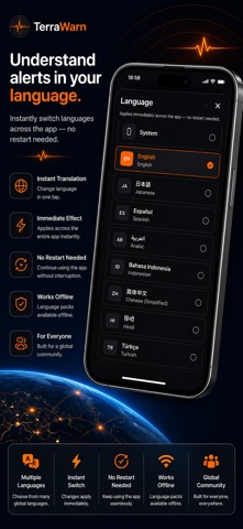
Every feature is fully translated across all 23 supported languages.
As always, TerraWarn stays free and works offline when you need it most.
Released Aug 7, 2026. Current version shipped Sep 8, 2026.
Store description
TerraWarn helps you stay informed about natural hazards and prepare for emergencies with hazard alerts, interactive maps, preparedness tools, emergency resources, and safety guidance.
IMPORTANT DISCLAIMER
TerraWarn is an independent application. It is NOT affiliated with, endorsed by, authorized by, or operated by any government, government agency, emergency service, or public authority. TerraWarn does not represent a government entity and is not a government service.
Information is provided for informational and educational purposes only. It does not replace official emergency alerts, instructions from authorities, professional medical advice, or emergency services. In an emergency, contact local emergency services and follow official instructions.
SOURCES OF INFORMATION
TerraWarn uses information obtained or adapted from these publicly available sources:
• U.S. Geological Survey (USGS) — Earthquakes
https://earthquake.usgs.gov/
• NASA EONET — Natural events
https://eonet.gsfc.nasa.gov/
• Global Disaster Alert and Coordination System (GDACS) — Disaster alerts
https://www.gdacs.org/
• U.S. Centers for Disease Control and Prevention (CDC) — Health & emergency preparedness
https://www.cdc.gov/
• American Red Cross — First aid & preparedness
https://www.redcross.org/
• Ready.gov (U.S. Department of Homeland Security) — Hazard safety & preparedness
https://www.ready.gov/
• AirNow.gov (U.S. Environmental Protection Agency) — Air quality & wildfire smoke
https://www.airnow.gov/
• OpenStreetMap — Map data and nearby-facility locations (hospitals, pharmacies, fire and police stations)
https://www.openstreetmap.org/
Consult the original sources and relevant local authorities for authoritative and current information.
HAZARD ALERTS
View supported events including earthquakes, wildfires, floods, storms, volcanic activity, and other natural hazards. Choose the hazards you want to follow and configure available severity preferences.
INTERACTIVE HAZARD MAP
Explore supported hazard events on a map and view available details such as location, magnitude, depth, affected area, and event information. Where available, access the corresponding original source.
EMERGENCY CONTACTS
Quickly access emergency calling features and contact information. Emergency numbers vary by country and region and should be verified with local authorities.
EMERGENCY GUIDES
Access general safety information for earthquakes, floods, wildfires, hurricanes, severe storms, tornadoes, volcanic events, and other supported hazards. Guidance is based on the sources listed above and does not replace official instructions.
FIRST AID & MEDICAL GUIDES
Access general information about CPR, severe bleeding, burns, choking, stroke, heart attack, seizures, poisoning, and broken bones. Relevant content is based on publicly available American Red Cross and CDC guidance.
Medical information is educational only and does not replace professional medical training, diagnosis, treatment, or emergency medical care.
PREPAREDNESS
Create emergency checklists and track essential supplies such as water, food, first-aid items, flashlights, radios, and important documents.
MEDICAL PROFILE
Store emergency information you choose to enter, including blood type, allergies, medications, and medical notes. This organizational feature does not provide diagnosis or treatment.
NEARBY HELP
Use location-based features to find supported nearby hospitals, pharmacies, fire stations, police stations, and other facilities, sourced from OpenStreetMap. Always verify critical information during an emergency.
PRIVACY
No account is required. Location is used when needed for location-based features such as nearby hazards and facilities.
TerraWarn is an independent informational and preparedness app, NOT a government application. For authoritative emergency information, consult the original sources above and follow instructions from local authorities.
See this store page in another country
Prices, ranks and reviews are per country. Revenue above is already worldwide.