ASO keywords
Most repeated terms in the listing. Highlighted ones also appear in the title.
water15trip8fish6see6bite5temperature5plan run5record trip5water temperature5plan4analysis4waypoints4learn water3run ocean3ocean analysis3analysis water3temperature water3water color3chart water3places fish3raised fish3run3record3offshore3
What's new in 3.9.70
Log your day by talking instead of typing.
New Features
• Log by Voice: say what you caught, what bit, and what you raised, check the list, then save it to your trip
• Say "start a trip" to Siri and Salty opens and starts recording
Improvements
• Siri understands more ways to log a fish, like "caught a sail," "got a bite," and "raised one"
• Waypoints you save on another phone show up on this one right away
• Tap a boat to see its size, class, permits, and home port (Elite)
• Boats with no name are labeled by their number, and boats are on the map by default until you turn them off (Elite)
• Learn Salty shows your progress on the map and opens your next lesson
Bug Fixes
• The trip graph shows time of day along the bottom
• The trip sheet shows the crosshair's coordinates and depth, and the crosshair stays hidden in playback and satellite tracking
• Fish with no species show as fish, not "unspecified"
• Waypoint water temperature shows in your temperature scale
Released Oct 11, 2025. Current version shipped Oct 22, 2026.
Store description
Plan the Run. Record the Trip. Learn the Water.
Salty is offshore planning and analysis. Plan the run on ocean analysis, record the trip, and keep a logbook that shows the conditions behind every bite. The more you fish it, the sharper it gets.
Plan the Run
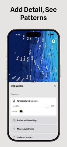
• Ocean Analysis: water temperature, water color, currents, sea surface height, salinity, subsurface temperature, dissolved oxygen and more, for your region every day
• Overlay Datasets: put two kinds of ocean data on one chart and see where they agree
• Temperature Breaks and Eddies outlined on the chart
• Water Playback: play recent satellite passes and watch the water move
• Weather: wind, gusts, pressure and radar on the same chart as your water
• Shaded Relief and Depth Contours to see the bottom you fish
• AIS: see the boats working near you and where they've been
• Bite Windows, tides and live buoys for the places you fish
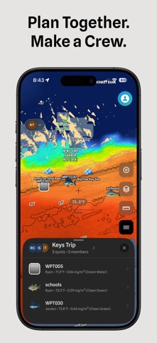
• Collaborative Planning: share waypoints, trips and your map with your crew
Record the Trip
• Trip Tracker records your trail, speed and depth
• Hands-Free Logging: log bites, catches and raised fish from the Lock Screen or with Siri
• End-of-Trip Summary: confirm your catches, bites and raised fish by species when you're back
• Waypoints save the places you fish, with the water at each one
• Position Sharing: send a link so someone ashore can see your boat
• Shareable Trip Images: post your day with your own photo behind the trail
Learn the Water
• Conditions at Every Bite: the water temperature, water color and depth at each bite
• Trip Analysis: the water along your trip and at each bite
• Season Patterns: see which conditions repeated across your season
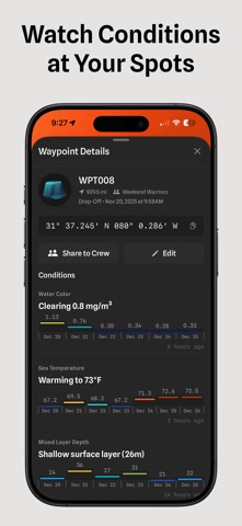
• Waypoint History: see how the water has changed at your waypoints
• Condition Alerts: pick the water you want at a waypoint, and we'll notify you when it's there
Ready Offshore
• 34 offshore regions on five continents
• Offline Maps: download your water before you lose signal
• Saved Maps and Saved Overlays bring back your setup in one tap
• New Satellite Pass Alerts when new water temperature or chlorophyll arrives for your region
• Import and export waypoints as GPX files for your chartplotter
Start with a free preview.
Features and data availability vary by plan and region.
Terms of Use (EULA):
https://www.apple.com/legal/internet-services/itunes/dev/stdeula/
Privacy Policy:
https://saltyoffshore.com/privacy
See this store page in another country
Prices, ranks and reviews are per country. Revenue above is already worldwide.